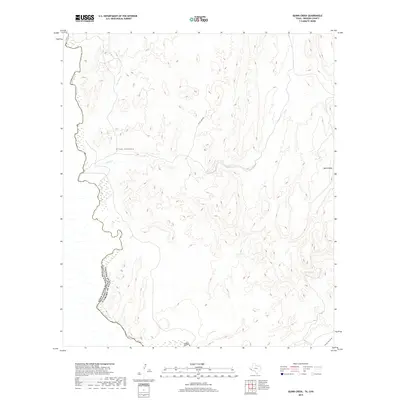
2019 Map of Quinn Creek
USGS Topo · Published 2019About this map
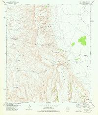
The Rio Grande serves as the international boundary between the United States and Mexico in this high-desert region of Presidio County. This terrain is defined by complex drainage networks that cut through the arid landscape toward the river, including Van Horn Cr, Quinn Cr, and the Arroyo Enmedio. A prominent geographic landmark, Quinn Mesa, rises in the eastern portion of the map, overlooking the surrounding canyons. Human presence is sparse, marked primarily by White Tank Rd and the vital water source at Siffer Spring. The map captures a section of the border where seasonal watercourses like Arroyo San Carlos dictate the movement and geography of the land, illustrating the isolation and natural infrastructure of the Big Bend region in the early twenty-first century.
Find a feature on this map
10 named features on this map. Tap any name to fly to it.
Don’t see what you’re looking for? This feature index may not catch every label — zoom into the map to look around manually.
Map Details
Editions of this 2019 Quinn Creek Map
This is the sole edition of this map. No revisions or reprints were ever made.
Other maps of this area

1892 · Chispa
USGS Topo · 1:125,000

1895 · Chispa
USGS Topo · 1:125,000

1896 · San Carlos
USGS Topo · 1:125,000

1897 · Chispa
USGS Topo · 1:125,000

1959 · Marfa
USGS Topo · 1:250,000

1965 · Marfa
USGS Topo · 1:250,000
1972 · Soldier Spring
USGS Topo · 1:24,000
1972 · Bennett Ranch
USGS Topo · 1:24,000
1978 · Gettysburg Peak
USGS Topo · 1:24,000
1978 · Vieja Pass
USGS Topo · 1:24,000