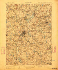
1908 Map of Quinsigamond
USGS Topo · Published 1910About this map
Wachuseet Mountain anchors the high ground of this central Massachusetts landscape, where a sophisticated network of 19th-century infrastructure converges. The massive Wachusett Reservoir dominates the upper Nashua River valley, surrounded by industrial and transport hubs like Sterling Junction and Clinton. The railroad-driven growth of the era is evident in the dense crossings of the Boston and Maine RR and the Central Massachusetts RR, which linked the many small hill-town depots such as Princeton Depot and Hubbardston Sta to the regional commerce of Worcester. Beyond the urbanized areas, the topography is defined by prominent family-named landmarks like Asnebumskit Hill and Calamint Hill. This 1880s survey data, updated just after the turn of the century, also marks institutional landmarks such as the State Lunatic Hospital, reflecting the social and civic landscape of the commonwealth before the major highway expansions of the following century.
Find a feature on this map
214 named features on this map. Tap any name to fly to it.
Don’t see what you’re looking for? This feature index may not catch every label — zoom into the map to look around manually.
Map Details
Editions of this 1908 Quinsigamond Map
3 editions found

Other maps of this area

1885 · Worcester
USGS Topo · 1:62,500

1886 · Worcester
USGS Topo · 1:62,500

1886 · Blackstone
USGS Topo · 1:62,500

1886 · Lowell
USGS Topo · 1:62,500

1886 · Framingham
USGS Topo · 1:62,500

1887 · Brookfield
USGS Topo · 1:62,500

1887 · Franklin
USGS Topo · 1:62,500

1887 · Winchendon
USGS Topo · 1:62,500

1887 · Providence
USGS Topo · 1:62,500

1887 · Marlboro
USGS Topo · 1:62,500