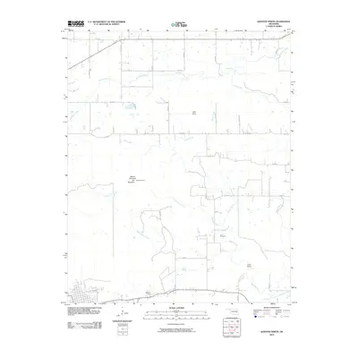
2010 Map of Quinton North
USGS Topo · Published 2010About this map
Lona Valley anchors the southeastern landscape of this Quinton-area survey, where a network of rural routes like E 1290 Rd and N 4350 Rd connect scattered homesteads across the drainages of Beaver Creek and Little Beaver Creek. The terrain is defined by prominent elevations such as Beaver Mountain, Blu Mountain, and Little Knob, providing a clear record of the area's topography before modern development. Notable local history landmarks include the Lona Cemetery and Quinton Cemetery, which serve as vital points of interest for genealogists tracking family roots in this corner of Oklahoma. The presence of the OETA Channel 3 tower atop the ridgeline highlights the intersection of modern communications infrastructure with a largely traditional rural landscape. This region, carved by waterways like Emachaya Creek and Elm Creek, reflects a long-standing pattern of ridge-and-valley settlement.
Find a feature on this map
34 named features on this map. Tap any name to fly to it.
Don’t see what you’re looking for? This feature index may not catch every label — zoom into the map to look around manually.
Map Details
Editions of this 2010 Quinton North Map
This is the sole edition of this map. No revisions or reprints were ever made.
Other maps of this area

1900 · Sansbois
USGS Topo · 1:125,000

1909 · Sans Bois
USGS Topo · 1:125,000

1911 · Sansbois
USGS Topo · 1:125,000

1946 · Fort Smith
USGS Topo · 1:250,000

1962 · Stigler West
USGS Topo · 1:24,000

1963 · Porum
USGS Topo · 1:24,000

1963 · Texanna
USGS Topo · 1:24,000

1965 · Fort Smith
USGS Topo · 1:250,000

1967 · Fort Smith
USGS Topo · 1:250,000
1969 · Kinta
USGS Topo · 1:24,000