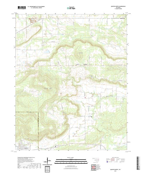
2022 Map of Quinton North
USGS Topo · Published 2022About this map
Quinton sits at the southwestern edge of this landscape, marking a transition from the structured street grids of the settlement to the winding drainage basins of Beaver Cr and Little Beaver Cr. The terrain is defined by prominent elevations such as Beaver Mtn and Blu Mtn, which rise sharply along the Pittsburg Co Haskell Co boundary line. In the northern reaches, Whitefield serves as another focal point of human activity near the winding path of Emachaya Cr. This area is dotted with small rural communities and resting places, including Hughart and Lona Valley, the latter featuring the Lona Valley Cem. The network of section roads like e1250 RD and Beaver Mt Rd highlights the organized land divisions typical of eastern Oklahoma, providing access to remote locations like Little Knob and various family-linked cemeteries.
Find a feature on this map
34 named features on this map. Tap any name to fly to it.
Don’t see what you’re looking for? This feature index may not catch every label — zoom into the map to look around manually.
Map Details
Editions of this 2022 Quinton North Map
This is the sole edition of this map. No revisions or reprints were ever made.
Other maps of this area

1900 · Sansbois
USGS Topo · 1:125,000

1909 · Sans Bois
USGS Topo · 1:125,000

1911 · Sansbois
USGS Topo · 1:125,000

1946 · Fort Smith
USGS Topo · 1:250,000

1962 · Stigler West
USGS Topo · 1:24,000

1963 · Porum
USGS Topo · 1:24,000

1963 · Texanna
USGS Topo · 1:24,000

1965 · Fort Smith
USGS Topo · 1:250,000

1967 · Fort Smith
USGS Topo · 1:250,000
1969 · Kinta
USGS Topo · 1:24,000