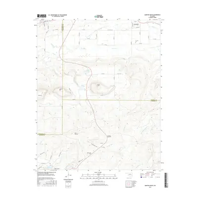
2016 Map of Quinton South
USGS Topo · Published 2016About this map
The Sans Bois Mountains dominate this landscape south of Quinton, where the borders of Pittsburg, Haskell, and Latimer counties meet. The small settlement of Lewisville sits in the northern section, anchored by the Lewisville Cem and surrounded by a network of rural roads such as W Brown St and e1305 RD. This area is defined by its significant relief, with prominent peaks like Tucker Knob, Panther Mtn, and Iron Post Mtn rising above the drainages. Water management and drainage patterns are clear through features like Quinton City Lake and Lake Wayne Wallace, while numerous creeks including Sans Bois Cr and Fourche Maline carve through the terrain. The southern reaches of the map include the Black Gum Flats and Rough Canyon, showing a complex topography that transitions into a protected Wildlife Management area.
Find a feature on this map
55 named features on this map. Tap any name to fly to it.
Don’t see what you’re looking for? This feature index may not catch every label — zoom into the map to look around manually.
Map Details
Editions of this 2016 Quinton South Map
This is the sole edition of this map. No revisions or reprints were ever made.
Other maps of this area

1900 · Sansbois
USGS Topo · 1:125,000

1901 · Tuskahoma
USGS Topo · 1:125,000

1908 · Tuskahoma
USGS Topo · 1:125,000

1909 · Tuskahoma
USGS Topo · 1:125,000

1909 · Sans Bois
USGS Topo · 1:125,000

1911 · Sansbois
USGS Topo · 1:125,000

1940 · Red Oak
USGS Topo · 1:62,500

1943 · Red Oak
USGS Topo · 1:62,500

1946 · Fort Smith
USGS Topo · 1:250,000

1950 · Mcalester
USGS Topo · 1:250,000