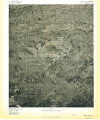
1977 Map of Quinton South
USGS Topo · Published 1977About this map
Quinton and Lewisville anchor the northern edge of this orthophoto study, which captures the Latimer County landscape as it appeared in the late 1970s. The map illustrates the transition from the relatively flat valley floor of Sans Bois Creek into the rising elevations of the Sans Bois Mountains to the south. Notable topographic landmarks such as Tucker Knob and Panther Mountain dominate the central terrain, offering a clear view of the timbered ridges and drainage patterns that define this portion of eastern Oklahoma. Produced by the Geological Survey in cooperation with the Soil Conservation Service, the imagery documents the rural road networks and clearing patterns of the era, including the path of Mountain Fork through the southern highlands. This aerial perspective provides researchers with a precise record of land use and vegetation during a period of modern agricultural and environmental monitoring.
Find a feature on this map
7 named features on this map. Tap any name to fly to it.
Don’t see what you’re looking for? This feature index may not catch every label — zoom into the map to look around manually.
Map Details
Editions of this 1977 Quinton South Map
This is the sole edition of this map. No revisions or reprints were ever made.
Other maps of this area

1900 · Sansbois
USGS Topo · 1:125,000

1901 · Tuskahoma
USGS Topo · 1:125,000

1908 · Tuskahoma
USGS Topo · 1:125,000

1909 · Tuskahoma
USGS Topo · 1:125,000

1909 · Sans Bois
USGS Topo · 1:125,000

1911 · Sansbois
USGS Topo · 1:125,000

1940 · Red Oak
USGS Topo · 1:62,500

1943 · Red Oak
USGS Topo · 1:62,500

1946 · Fort Smith
USGS Topo · 1:250,000

1950 · Mcalester
USGS Topo · 1:250,000