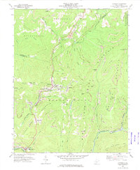
1972 Map of Quinwood
USGS Topo · Published 1974About this map
Extensive bituminous coal mining operations define the landscape of the Greenbrier and Nicholas county border in the early 1970s. The Nicholas Fayette and Greenbrier RR follows the winding path of the Meadow River, serving a string of industrial settlements including Quinwood, Crichton, and Marfrance. The map reveals a high density of Strip Mines and Mine Dumps carved into the ridges, illustrating the heavy reliance on extraction that shaped these Appalachian communities. Amidst this industrial activity, local life is anchored by institutions like the Greenbrier West High Sch and numerous country churches, such as Chestnut Grove Ch and Advent Ch. The terrain is characterized by high summits including Peaser Knob and Pollock Mountain, while the eastern portion of the survey extends into the protected boundary of the Monongahela National Forest.
Find a feature on this map
64 named features on this map. Tap any name to fly to it.
Don’t see what you’re looking for? This feature index may not catch every label — zoom into the map to look around manually.
Map Details
Editions of this 1972 Quinwood Map
2 editions found
Other maps of this area

1887 · Hinton
USGS Topo · 1:125,000

1889 · Nicholas
USGS Topo · 1:125,000

1891 · Nicholas
USGS Topo · 1:125,000

1892 · Hinton
USGS Topo · 1:125,000

1901 · Nicholas
USGS Topo · 1:125,000

1912 · Meadow Creek
USGS Topo · 1:48,000

1914 · Winona
USGS Topo · 1:48,000

1915 · Meadow Creek
USGS Topo · 1:62,500

1916 · Winona
USGS Topo · 1:62,500

1918 · Richwood
USGS Topo · 1:62,500