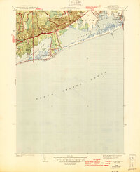
1944 Map of Quonochontaug
USGS Topo · Published 1944About this map
Burlingame Reservation and the Woody Hill State Reservation anchor the inland landscape of this mid-century coastal survey. The territory is defined by its massive salt ponds, where Ninigret Pond and Quonochontaug Pond are protected from the open waters of Block Island Sound by narrow, sandy barrier beaches. These coastal features shaped the development of early summer colonies and settlements such as Shelter Harbor and the village of Quonochontaug.
Find a feature on this map
33 named features on this map. Tap any name to fly to it.
Don’t see what you’re looking for? This feature index may not catch every label — zoom into the map to look around manually.
Map Details
Editions of this 1944 Quonochontaug Map
2 editions found
Other maps of this area

1889 · Stonington
USGS Topo · 1:62,500

1889 · Charlestown
USGS Topo · 1:62,500

1889 · Block Island
USGS Topo · 1:62,500

1893 · Stonington
USGS Topo · 1:62,500

1894 · Block Island
USGS Topo · 1:62,500

1899 · Block Island
USGS Topo · 1:62,500

1904 · Montauk
USGS Topo · 1:62,500

1919 · Charlestown
USGS Topo · 1:62,500

1921 · Charlestown
USGS Topo · 1:62,500

1921 · Stonington
USGS Topo · 1:62,500