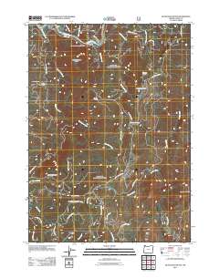
2011 Map of Quosatana Butte
USGS Topo · Published 2011About this map
The Rogue River carves through the northern reaches of this Curry County landscape, passing the riverside settlement at Fry Landing and the northern trailhead at Bacon Flat. This 2011 survey reveals a terrain defined by steep drainage systems and prominent high points, where the winding Agness Rd and Silver Creek Rd provide the primary access to this interior wilderness. To the south, the headwaters of the Pistol River and Lawson Creek originate among a series of named summits, including the distinctive Quosatana Butte and Sugarloaf Mountain.
Find a feature on this map
42 named features on this map. Tap any name to fly to it.
Don’t see what you’re looking for? This feature index may not catch every label — zoom into the map to look around manually.
Map Details
Editions of this 2011 Quosatana Butte Map
This is the sole edition of this map. No revisions or reprints were ever made.
Other maps of this area

1899 · Port Orford
USGS Topo · 1:125,000

1903 · Port Orford
USGS Topo · 1:125,000

1954 · Coos Bay
USGS Topo · 1:250,000

1954 · Port Orford
USGS Topo · 1:62,500

1954 · Gold Beach
USGS Topo · 1:62,500

1954 · Collier Butte
USGS Topo · 1:62,500

1954 · Agness
USGS Topo · 1:62,500

1958 · Coos Bay
USGS Topo · 1:250,000

1962 · Coos Bay
USGS Topo · 1:250,000
1986 · Sundown Mtn
USGS Topo · 1:24,000