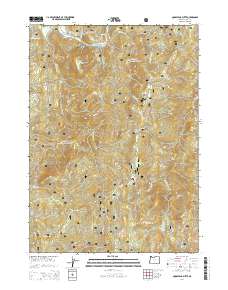
2014 Map of Quosatana Butte
USGS Topo · Published 2014About this map
The Rogue River carves through the northern reaches of this territory, defining a landscape of dramatic elevation and named water features like Hayes Eddy and Silver Creek Riffle. This portion of the Siskiyou National Forest is characterized by its significant peaks and high-elevation clearings, including Quosatana Butte, Skookumhouse Butte, and the open expanse of Wildhorse Prairie. A complex network of Forest Service roads, such as Agness Rd and Signal Butte Rd, provides the primary access through these steep drainages.
Find a feature on this map
47 named features on this map. Tap any name to fly to it.
Don’t see what you’re looking for? This feature index may not catch every label — zoom into the map to look around manually.
Map Details
Editions of this 2014 Quosatana Butte Map
This is the sole edition of this map. No revisions or reprints were ever made.
Other maps of this area

1899 · Port Orford
USGS Topo · 1:125,000

1903 · Port Orford
USGS Topo · 1:125,000

1954 · Coos Bay
USGS Topo · 1:250,000

1954 · Port Orford
USGS Topo · 1:62,500

1954 · Gold Beach
USGS Topo · 1:62,500

1954 · Collier Butte
USGS Topo · 1:62,500

1954 · Agness
USGS Topo · 1:62,500

1958 · Coos Bay
USGS Topo · 1:250,000

1962 · Coos Bay
USGS Topo · 1:250,000
1986 · Sundown Mtn
USGS Topo · 1:24,000