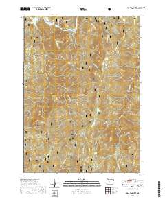
2020 Map of Quosatana Butte
USGS Topo · Published 2020About this map
The Rogue Wild and Scenic River carves through the northern reaches of this landscape, defining a corridor of historic river navigation and landmarks. Watermen and locals once relied on distinct river features like Lowery Riffle, Bacon Flat, and Hedge Eddy to navigate the moving waters. To the south, the terrain rises sharply into the peaks of the Siskiyou National Forest, including the prominent Quosatana Butte and Sugarloaf Mtn.
Find a feature on this map
32 named features on this map. Tap any name to fly to it.
Don’t see what you’re looking for? This feature index may not catch every label — zoom into the map to look around manually.
Map Details
Editions of this 2020 Quosatana Butte Map
This is the sole edition of this map. No revisions or reprints were ever made.
Other maps of this area

1899 · Port Orford
USGS Topo · 1:125,000

1903 · Port Orford
USGS Topo · 1:125,000

1954 · Coos Bay
USGS Topo · 1:250,000

1954 · Port Orford
USGS Topo · 1:62,500

1954 · Gold Beach
USGS Topo · 1:62,500

1954 · Collier Butte
USGS Topo · 1:62,500

1954 · Agness
USGS Topo · 1:62,500

1958 · Coos Bay
USGS Topo · 1:250,000

1962 · Coos Bay
USGS Topo · 1:250,000
1986 · Sundown Mtn
USGS Topo · 1:24,000