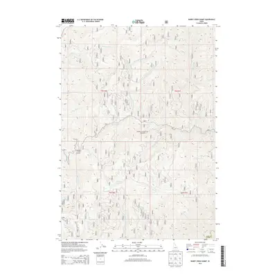
2013 Map of Rabbit Creek Summit
USGS Topo · Published 2013About this map
Rabbit Creek Summit serves as a central high point in this 2013 survey of the deep wilderness along the Boise National Forest border. The landscape is defined by a complex drainage system where Rabbit Creek and its northern and southern forks converge, surrounded by a dense network of forest service roads including routes 327 and 315. These roads follow the narrow ridgelines and creek bottoms, providing access to the steep drainage basins of Mores Creek and the Middle Fork Thorn Creek. The map documents the boundary between Boise and Elmore Counties, illustrating how the high-elevation terrain dictates the movement of both water and travelers. Small tributaries like Hoodoo Creek, Meadow Creek, and German Creek carve out the secondary gulches, showing the intricate hydrology of the Boise River watershed.
Find a feature on this map
101 named features on this map. Tap any name to fly to it.
Don’t see what you’re looking for? This feature index may not catch every label — zoom into the map to look around manually.
Map Details
Editions of this 2013 Rabbit Creek Summit Map
This is the sole edition of this map. No revisions or reprints were ever made.
Other maps of this area

1894 · Idaho Basin
USGS Topo · 1:125,000

1955 · Hailey
USGS Topo · 1:250,000

1957 · Pioneerville
USGS Topo · 1:24,000

1957 · Idaho City
USGS Topo · 1:24,000

1959 · Hailey
USGS Topo · 1:250,000

1962 · Hailey
USGS Topo · 1:250,000

1964 · Sheep Creek
USGS Topo · 1:24,000

1964 · Twin Springs
USGS Topo · 1:24,000
1969 · Arrowrock Reservoir NE
USGS Topo · 1:24,000
1972 · Rabbit Creek Summit
USGS Topo · 1:24,000