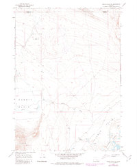
1966 Map of Rabbit Hills NE
USGS Topo · Published 1980About this map
Sunstone Area occupies the northern highlands of this high-desert landscape along the border of Harney and Lake counties. The terrain drops from these uplands into the wide depressions of Rabbit Basin and Warner Valley, where the drainage of Rabbit Creek eventually feeds toward the Warner Lakes system. This 1966 survey, updated with late-1970s photogrammetric data, illustrates a region defined by its hydrologic extremes and range-land utility.
Find a feature on this map
10 named features on this map. Tap any name to fly to it.
Don’t see what you’re looking for? This feature index may not catch every label — zoom into the map to look around manually.
Map Details
Editions of this 1966 Rabbit Hills NE Map
2 editions found
Other maps of this area

1955 · Adel
USGS Topo · 1:250,000

1957 · Adel
USGS Topo · 1:250,000

1958 · Adel
USGS Topo · 1:250,000

1962 · Adel
USGS Topo · 1:250,000

1966 · Rabbit Hills NE
USGS Topo · 1:24,000

1966 · Rabbit Hills NW
USGS Topo · 1:24,000

1967 · Flagstaff Lake
USGS Topo · 1:24,000

1967 · Rabbit Hills SW
USGS Topo · 1:24,000

1967 · Campbell Lake
USGS Topo · 1:24,000

1967 · Bluejoint Lake West
USGS Topo · 1:24,000