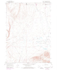
1966 Map of Rabbit Hills NW
USGS Topo · Published 1980About this map
Rabbit Basin defines the central geography of this remote Lake County landscape, where the high desert terrain transitions between prominent ridges and seasonal watercourses. The 1966 survey, updated in 1980, shows a sparse human footprint centered on livestock and ranching infrastructure, such as M C Corral and the small settlement of Foley. Transportation is largely restricted to rugged routes like Hogback Road and various jeep trails that navigate the elevation changes between Flint Ridge and the Flint Hills.
Find a feature on this map
14 named features on this map. Tap any name to fly to it.
Don’t see what you’re looking for? This feature index may not catch every label — zoom into the map to look around manually.
Map Details
Editions of this 1966 Rabbit Hills NW Map
2 editions found
Other maps of this area

1955 · Klamath Falls
USGS Topo · 1:250,000

1955 · Adel
USGS Topo · 1:250,000

1957 · Adel
USGS Topo · 1:250,000

1958 · Klamath Falls
USGS Topo · 1:250,000

1958 · Adel
USGS Topo · 1:250,000

1962 · Adel
USGS Topo · 1:250,000

1966 · Rabbit Hills NE
USGS Topo · 1:24,000

1966 · Rabbit Hills NW
USGS Topo · 1:24,000

1967 · Flagstaff Lake
USGS Topo · 1:24,000

1967 · Rabbit Hills SW
USGS Topo · 1:24,000