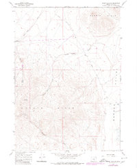
1967 Map of Rabbit Hills SW
USGS Topo · Published 1980About this map
The Warner Valley edge and the high desert terrain of Lake County define this landscape as it was documented in the late 1960s and updated in 1980. The map reveals a land structured by water and elevation, where the Rabbit Hills and Coyote Hills dominate the topography. Localized drainage systems such as Mary Ann Draw, Miners Draw, and Mulkey Wells Draw indicate the historical importance of water management in this arid environment. Traces of human activity are sparse but significant, primarily represented by the Hogback Road and various Jeep Trails that traverse the sagebrush. These routes, alongside features like Hogback Well and several Spring points, suggest a landscape primarily used for ranching and resource access. The presence of Alkali Flats in the eastern section highlights the basin-and-range characteristics of this high Oregon plateau.
Find a feature on this map
19 named features on this map. Tap any name to fly to it.
Don’t see what you’re looking for? This feature index may not catch every label — zoom into the map to look around manually.
Map Details
Editions of this 1967 Rabbit Hills SW Map
2 editions found

Other maps of this area

1955 · Klamath Falls
USGS Topo · 1:250,000

1955 · Adel
USGS Topo · 1:250,000

1957 · Adel
USGS Topo · 1:250,000

1958 · Klamath Falls
USGS Topo · 1:250,000

1958 · Adel
USGS Topo · 1:250,000

1962 · Adel
USGS Topo · 1:250,000

1966 · Rabbit Hills NE
USGS Topo · 1:24,000

1966 · Rabbit Hills NW
USGS Topo · 1:24,000

1967 · Flagstaff Lake
USGS Topo · 1:24,000

1967 · Plush
USGS Topo · 1:24,000