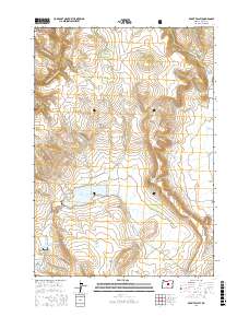
2017 Map of Rabbit Valley
USGS Topo · Published 2017About this map
The North Fork Crooked River flows through the northwestern corner of this high-desert landscape, where the Ochoco National Forest meets a network of ranching and irrigation infrastructure. The terrain is defined by a series of prominent rises including Pine Mtn, Juniper Butte, and Isadore Butte, which overlook the expansive basin of Rabbit Valley.
Find a feature on this map
45 named features on this map. Tap any name to fly to it.
Don’t see what you’re looking for? This feature index may not catch every label — zoom into the map to look around manually.
Map Details
Editions of this 2017 Rabbit Valley Map
This is the sole edition of this map. No revisions or reprints were ever made.
Other maps of this area

1932 · Dayville
USGS Topo · 1:125,000

1936 · Dayville
USGS Topo · 1:125,000

1955 · Bend
USGS Topo · 1:250,000

1955 · Canyon City
USGS Topo · 1:250,000

1957 · Bend
USGS Topo · 1:250,000

1958 · Bend
USGS Topo · 1:250,000

1959 · Canyon City
USGS Topo · 1:250,000

1965 · Williams Prairie
USGS Topo · 1:24,000

1966 · Keys Creek
USGS Topo · 1:24,000

1966 · Little Summit Prairie
USGS Topo · 1:24,000