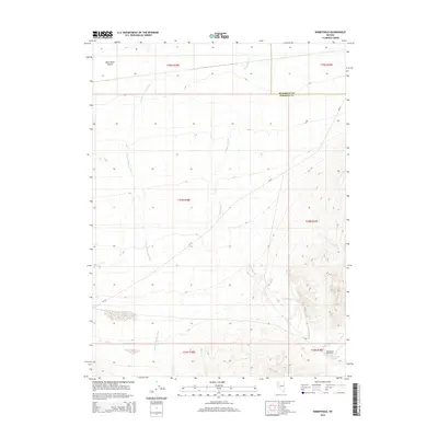
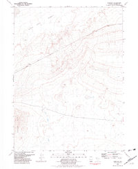
2014 Map of Rabbithole
USGS Topo · Published 2014About this map
The high desert landscape of the Humboldt and Pershing County border comes into sharp focus through this USGS topographical study. Centered on the intermittent drainage of Rabbithole Creek, the map details a region defined by water scarcity and historical transit. The presence of Rabbithole (Historical) and Rabbithole Springs marks a vital stop for travelers in an otherwise arid environment where Granite Springs Wash carves through the terrain toward the vast expanse of the Black Rock Desert in the northwest. The route of NV-49 traverses the area, providing a modern link through a topography that remains largely dominated by the natural features of the Great Basin. This edition records the elevation contours and ephemeral watercourses that have dictated movement and settlement patterns in this part of Nevada for generations.
Find a feature on this map
13 named features on this map. Tap any name to fly to it.
Don’t see what you’re looking for? This feature index may not catch every label — zoom into the map to look around manually.
Map Details
Editions of this 2014 Rabbithole Map
This is the sole edition of this map. No revisions or reprints were ever made.
Other maps of this area

1931 · Lovelock
USGS Topo · 1:250,000

1935 · Lovelock
USGS Topo · 1:250,000

1955 · Lovelock
USGS Topo · 1:250,000

1959 · Lovelock
USGS Topo · 1:250,000
1981 · Sheep Spring
USGS Topo · 1:24,000
1981 · Black Rock Point East
USGS Topo · 1:24,000
1981 · Rabbithole NE
USGS Topo · 1:24,000

1981 · Dead Horse Canyon NE
USGS Topo · 1:24,000

1981 · Placerites
USGS Topo · 1:24,000
1981 · Cholona
USGS Topo · 1:24,000