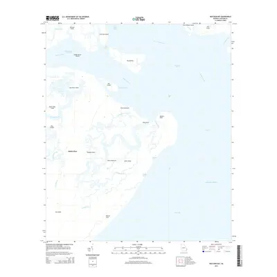
2014 Map of Raccoon Key
USGS Topo · Published 2014About this map
Ossabaw Island and its surrounding tidal marshes define this coastal landscape south of Savannah. The interior of the island contains specific named locales such as Middle Place, Horse Hammock, and Harry Hammock, suggesting established areas of residence or activity amidst the maritime forest. The intricate network of tidal waterways is dominated by the Ogeechee River and the Intracostal Waterway, which navigate through hazardous passages like Hell Gate. These estuarine channels carve out a complex geography of smaller landforms, including Raccoon Key, Cane Patch Island, and Spider Ridge. The map captures the interface between the mainland waters and the open Atlantic Ocean, providing a detailed view of the barrier island's topography including Eleanor Pond and the extensive Peters Bay.
Find a feature on this map
39 named features on this map. Tap any name to fly to it.
Don’t see what you’re looking for? This feature index may not catch every label — zoom into the map to look around manually.
Map Details
Editions of this 2014 Raccoon Key Map
This is the sole edition of this map. No revisions or reprints were ever made.
Other maps of this area

1920 · Wassaw Sound
USGS Topo · 1:62,500

1928 · St Catherines Island
USGS Topo · 1:62,500

1943 · St Catherines Island
USGS Topo · 1:62,500

1944 · Ossabaw Island
USGS Topo · 1:62,500

1945 · St. Catherine's Island
USGS Topo · 1:62,500

1945 · Ossabaw Island
USGS Topo · 1:62,500

1945 · Wassaw Sound
USGS Topo · 1:62,500

1946 · Brunswick
USGS Topo · 1:250,000

1948 · Brunswick
USGS Topo · 1:250,000
1954 · St Catherines Sound
USGS Topo · 1:24,000