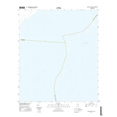
2017 Map of Raccoon Key OE S
USGS Topo · Published 2017About this map
The Atlantic Ocean dominates this coastal offshore survey, where the open sea meets the jurisdictional lines of the Georgia coast. This map illustrates a transition point between Georgia's maritime counties, defined by the invisible boundary separating Chatham Co and Liberty Co Georgia. In the northwestern corner, a small portion of the coastal landscape is visible, featuring Willows Pond set back from the shoreline. The remainder of the sheet is primarily a study of the littoral waters and the official county limits that extend into the Atlantic. It serves as a precise modern reference for the spatial relationships between these coastal districts and the sea in the mid-2010s.
Find a feature on this map
5 named features on this map. Tap any name to fly to it.
Don’t see what you’re looking for? This feature index may not catch every label — zoom into the map to look around manually.
Map Details
Editions of this 2017 Raccoon Key OE S Map
This is the sole edition of this map. No revisions or reprints were ever made.
Other maps of this area

1920 · Wassaw Sound
USGS Topo · 1:62,500

1928 · St Catherines Island
USGS Topo · 1:62,500

1943 · St Catherines Island
USGS Topo · 1:62,500

1944 · Ossabaw Island
USGS Topo · 1:62,500

1945 · St. Catherine's Island
USGS Topo · 1:62,500

1945 · Ossabaw Island
USGS Topo · 1:62,500

1945 · Wassaw Sound
USGS Topo · 1:62,500

1946 · Brunswick
USGS Topo · 1:250,000

1948 · Brunswick
USGS Topo · 1:250,000
1954 · St Catherines Sound
USGS Topo · 1:24,000