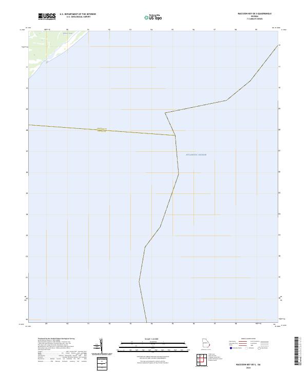
2024 Map of Raccoon Key OE S
USGS Topo · Published 2024About this map
The Atlantic Ocean dominates this coastal maritime environment, where the saltwater expanse meets the low-lying shoreline of Georgia. Located at the jurisdictional boundary between Chatham Co and Liberty Co, the area is defined by its coastal hydrology rather than terrestrial development. A small inland water body, Willows Pond, sits in the upper northwest corner of the sheet, providing a rare point of named topography in a landscape otherwise governed by the tides and the shifting offshore waters. This 2024 data highlights the county line's path as it extends from the marshes out into the open sea, illustrating the administrative geography of the Georgia coast.
Find a feature on this map
3 named features on this map. Tap any name to fly to it.
Don’t see what you’re looking for? This feature index may not catch every label — zoom into the map to look around manually.
Map Details
Editions of this 2024 Raccoon Key OE S Map
This is the sole edition of this map. No revisions or reprints were ever made.
Other maps of this area

1920 · Wassaw Sound
USGS Topo · 1:62,500

1928 · St Catherines Island
USGS Topo · 1:62,500

1943 · St Catherines Island
USGS Topo · 1:62,500

1944 · Ossabaw Island
USGS Topo · 1:62,500

1945 · St. Catherine's Island
USGS Topo · 1:62,500

1945 · Ossabaw Island
USGS Topo · 1:62,500

1945 · Wassaw Sound
USGS Topo · 1:62,500

1946 · Brunswick
USGS Topo · 1:250,000

1948 · Brunswick
USGS Topo · 1:250,000
1954 · St Catherines Sound
USGS Topo · 1:24,000