
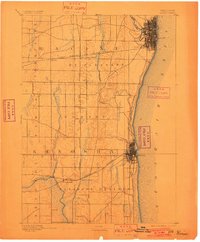
1892 Map of Racine
USGS Topo · Published 1892About this map
Racine and Kenosha stand as industrial anchors along the Lake Michigan shoreline in this late nineteenth-century survey. The landscape between these growing ports is defined by a rigorous grid of township boundaries, including Mt. Pleasant, Somers, and Pleasant Prairie. While the coastal cities show dense street networks, the interior is characterized by a high concentration of rail junctions, reflecting the era's dependence on steam transport.
Find a feature on this map
23 named features on this map. Tap any name to fly to it.
Don’t see what you’re looking for? This feature index may not catch every label — zoom into the map to look around manually.
Map Details
Editions of this 1892 Racine Map
2 editions found
Other maps of this area

1891 · Bayview
USGS Topo · 1:62,500

1891 · Muskego
USGS Topo · 1:62,500

1893 · Silver Lake
USGS Topo · 1:62,500

1901 · Bayview
USGS Topo · 1:62,500

1901 · Muskego
USGS Topo · 1:62,500

1905 · Racine
USGS Topo · 1:62,500

1906 · Silver Lake
USGS Topo · 1:62,500

1906 · Waukegan
USGS Topo · 1:62,500

1908 · Waukegan
USGS Topo · 1:62,500

1920 · Grays Lake
USGS Topo · 1:62,500