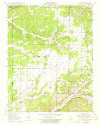
1949 Map of Racine
USGS Topo · Published 1979About this map
Tripoli Mines define much of the industrial character in this region along the Missouri-Oklahoma border, as documented in 1949 with later aerial revisions. The landscape is split between the rolling uplands of Five Mile Prairie and Burkhart Prairie, and the wooded drainage of Shoal Creek and Lost Creek. Small rural communities like Spring City, Hornet, and Racine serve as focal points for a network of country schools and churches, including the evocatively named Frog Pond Sch and New Hope Ch. The mapping of small family and local burial grounds, such as Blizzard Cem and Gibson Cem, provides significant genealogical value. Transportation is anchored by the St Louis San Francisco railroad and the burgeoning network of mid-century roads, including the scenic Wela Park area, illustrating the transition from a purely agricultural and mining economy to one of increasing connectivity.
Find a feature on this map
33 named features on this map. Tap any name to fly to it.
Don’t see what you’re looking for? This feature index may not catch every label — zoom into the map to look around manually.
Map Details
Editions of this 1949 Racine Map
2 editions found

Other maps of this area

1886 · Joplin
USGS Topo · 1:125,000

1886 · Carthage
USGS Topo · 1:125,000

1894 · Joplin
USGS Topo · 1:125,000

1894 · Carthage
USGS Topo · 1:125,000

1907 · Wyandotte
USGS Topo · 1:125,000

1909 · Wyandotte
USGS Topo · 1:125,000

1916 · Neosho
USGS Topo · 1:62,500

1947 · Joplin
USGS Topo · 1:250,000

1949 · Joplin
USGS Topo · 1:250,000

1949 · Seneca
USGS Topo · 1:24,000