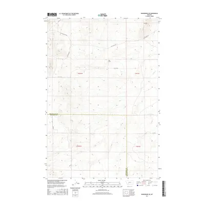
2017 Map of Radersburg SW
USGS Topo · Published 2017About this map
Lone Mtn rises above the high-altitude landscape where the boundary between Broadwater and Jefferson Counties meets. This 2017 survey documents a sparsely populated region of central Montana defined by seasonal drainages and a network of unpaved access roads serving remote land parcels. Key water features include the headwaters of Spring Creek and the deep incision of Salt Gulch, which cuts across the central township. The map illustrates how public land survey systems organize this terrain into sections, with transportation limited to established routes like Salt Gulch Rd and Hilltop Rd. The topographic detail highlights the complex ridge systems extending from the north fork of Lone Mountain, offering a precise record of contemporary Montana rangeland and drainage patterns.
Find a feature on this map
14 named features on this map. Tap any name to fly to it.
Don’t see what you’re looking for? This feature index may not catch every label — zoom into the map to look around manually.
Map Details
Editions of this 2017 Radersburg SW Map
This is the sole edition of this map. No revisions or reprints were ever made.
Other maps of this area

1886 · Fort Logan
USGS Topo · 1:250,000

1888 · Three Forks
USGS Topo · 1:250,000

1894 · Three Forks
USGS Topo · 1:250,000

1895 · Three Forks
USGS Topo · 1:250,000

1947 · Bozeman
USGS Topo · 1:250,000

1948 · Bozeman
USGS Topo · 1:250,000

1948 · White Sulphur Springs
USGS Topo · 1:250,000

1949 · Radersburg
USGS Topo · 1:62,500

1950 · Devils Fence
USGS Topo · 1:62,500

1950 · Three Forks
USGS Topo · 1:62,500