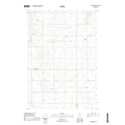
2020 Map of Radersburg SW
USGS Topo · Published 2020About this map
Lone Mtn dominates the northern horizon of this Montana landscape, where the high-altitude terrain is defined by a network of drainage systems and primitive access routes. The boundary between Jefferson County and Broadwater County cuts through the center of the sheet, marking a transition in jurisdictional oversight amid the open range. Water resources are scarce but vital, indicated by the course of Spring Cr and the deep relief of Salt Gulch. A series of historic routes, including Lone Mountain Rd and Salt Gulch Rd, navigate the complex topography, likely following paths established by early ranching or prospecting efforts. The presence of features like N Fork Lone Mountain and the W Fraction survey marker suggests a landscape that has been meticulously partitioned and mapped for resource management and land ownership in the modern era.
Find a feature on this map
15 named features on this map. Tap any name to fly to it.
Don’t see what you’re looking for? This feature index may not catch every label — zoom into the map to look around manually.
Map Details
Editions of this 2020 Radersburg SW Map
This is the sole edition of this map. No revisions or reprints were ever made.
Other maps of this area

1886 · Fort Logan
USGS Topo · 1:250,000

1888 · Three Forks
USGS Topo · 1:250,000

1894 · Three Forks
USGS Topo · 1:250,000

1895 · Three Forks
USGS Topo · 1:250,000

1947 · Bozeman
USGS Topo · 1:250,000

1948 · Bozeman
USGS Topo · 1:250,000

1948 · White Sulphur Springs
USGS Topo · 1:250,000

1949 · Radersburg
USGS Topo · 1:62,500

1950 · Devils Fence
USGS Topo · 1:62,500

1950 · Three Forks
USGS Topo · 1:62,500