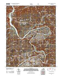
2011 Map of Radford North
USGS Topo · Published 2011About this map
The New River carves a dramatic path through this 2011 survey, defining the industrial and educational character of Radford and its surroundings. To the north, the river loops around the Radford Army Ammunition Plant at Horseshoe, while further south, the Southwest Virginia Memorial Bridge connects the city proper with Fairlawn. The city landscape is dominated by the Radford University campus and a network of residential neighborhoods including Belle Heth, Monroe Terrace, and Mill Village.
Find a feature on this map
165 named features on this map. Tap any name to fly to it.
Don’t see what you’re looking for? This feature index may not catch every label — zoom into the map to look around manually.
Map Details
Editions of this 2011 Radford North Map
This is the sole edition of this map. No revisions or reprints were ever made.
Other maps of this area

1890 · Dublin
USGS Topo · 1:125,000

1890 · Christiansburg
USGS Topo · 1:125,000

1891 · Dublin
USGS Topo · 1:125,000

1923 · Pearisburg
USGS Topo · 1:62,500

1923 · Waiteville
USGS Topo · 1:62,500

1931 · Waiteville
USGS Topo · 1:48,000

1932 · Pearisburg
USGS Topo · 1:48,000

1932 · Blacksburg
USGS Topo · 1:48,000

1937 · Pearisburg
USGS Topo · 1:62,500

1937 · Blacksburg
USGS Topo · 1:62,500