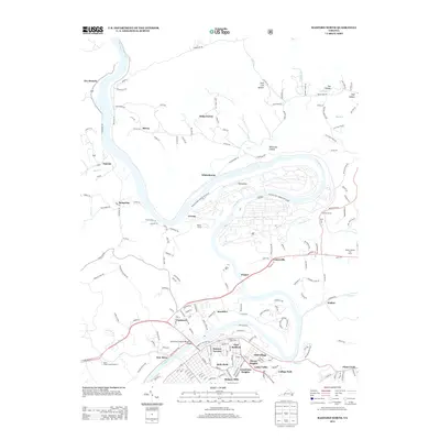
2013 Map of Radford North
USGS Topo · Published 2013About this map
The New River carves a dramatic oxbow through this Montgomery County landscape, defining the industrial and residential development around East Radford. A significant portion of the riverbend is occupied by the Radford Army Ammunition Plant, a massive facility featuring extensive infrastructure and the Horseshoe bend. These industrial footprints are balanced by established neighborhoods and suburbs such as Monroe Terrace, Belle Heth, and Grandview Heights, which spread north from the urban core toward the Southwest Virginia Memorial Bridge.
Find a feature on this map
182 named features on this map. Tap any name to fly to it.
Don’t see what you’re looking for? This feature index may not catch every label — zoom into the map to look around manually.
Map Details
Editions of this 2013 Radford North Map
This is the sole edition of this map. No revisions or reprints were ever made.
Other maps of this area

1890 · Dublin
USGS Topo · 1:125,000

1890 · Christiansburg
USGS Topo · 1:125,000

1891 · Dublin
USGS Topo · 1:125,000

1923 · Pearisburg
USGS Topo · 1:62,500

1923 · Waiteville
USGS Topo · 1:62,500

1931 · Waiteville
USGS Topo · 1:48,000

1932 · Pearisburg
USGS Topo · 1:48,000

1932 · Blacksburg
USGS Topo · 1:48,000

1937 · Pearisburg
USGS Topo · 1:62,500

1937 · Blacksburg
USGS Topo · 1:62,500