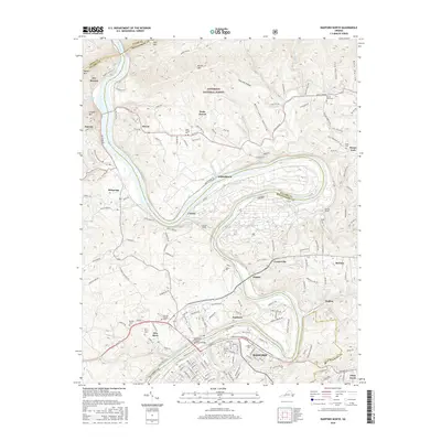
2016 Map of Radford North
USGS Topo · Published 2016About this map
The New River carves a dramatic, winding path through this region, defining the borders of Montgomery, Pulaski, and Giles counties. To the south, the city of Radford is anchored by Radford Univ and the Southwest Virginia Memorial Bridge, while the surrounding landscape is marked by several small settlements including Fairlawn, Belspring, and McCoy. The area's industrial and engineering history is evident in the rail infrastructure following the river, featuring structures like Pepper Tunnel and Milletts Tunnel.
Find a feature on this map
169 named features on this map. Tap any name to fly to it.
Don’t see what you’re looking for? This feature index may not catch every label — zoom into the map to look around manually.
Map Details
Editions of this 2016 Radford North Map
This is the sole edition of this map. No revisions or reprints were ever made.
Other maps of this area

1890 · Dublin
USGS Topo · 1:125,000

1890 · Christiansburg
USGS Topo · 1:125,000

1891 · Dublin
USGS Topo · 1:125,000

1923 · Pearisburg
USGS Topo · 1:62,500

1923 · Waiteville
USGS Topo · 1:62,500

1931 · Waiteville
USGS Topo · 1:48,000

1932 · Pearisburg
USGS Topo · 1:48,000

1932 · Blacksburg
USGS Topo · 1:48,000

1937 · Pearisburg
USGS Topo · 1:62,500

1937 · Blacksburg
USGS Topo · 1:62,500