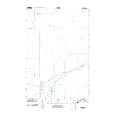
2010 Map of Radisson
USGS Topo · Published 2010About this map
The confluence of the Couderay River and the Chippewa River anchors this 2010 survey of the Radisson area. This landscape is defined by its water management and forestry infrastructure, notably featuring the Grimh WP 370 Dam and Arpin Dam along the river bends. To the north, the Pipestone Lookout Tower and Pipestone Camp suggest a history of timber management and forest surveillance, while roads like Blueberry Fire Ln and Ashegon Fire Ln carve through the wooded terrain. Local history and genealogy are centered around the town, where Radisson Cemetery sits near the riverbanks. The map documents a rugged network of water features, including the Pipestone Falls and Bellile Falls, alongside various named drainages such as Yankee Joe Creek and Crooked Rapids Creek, which flow through the northern reaches of Sawyer County.
Find a feature on this map
40 named features on this map. Tap any name to fly to it.
Don’t see what you’re looking for? This feature index may not catch every label — zoom into the map to look around manually.
Map Details
Editions of this 2010 Radisson Map
This is the sole edition of this map. No revisions or reprints were ever made.
Other maps of this area

1944 · Exeland
USGS Topo · 1:48,000

1944 · Couderay
USGS Topo · 1:48,000

1944 · Radisson
USGS Topo · 1:48,000

1945 · Meteor
USGS Topo · 1:48,000

1947 · Exeland
USGS Topo · 1:48,000

1948 · Couderay
USGS Topo · 1:48,000

1949 · Radisson
USGS Topo · 1:48,000

1949 · Meteor
USGS Topo · 1:48,000

1953 · Rice Lake
USGS Topo · 1:250,000

1959 · Rice Lake
USGS Topo · 1:250,000