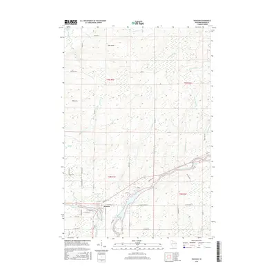
2015 Map of Radisson
USGS Topo · Published 2015About this map
The Chippewa River and Couderay River converge near the settlement of Radisson, forming a complex hydrographic landscape defined by the Radisson Flowage and Grimm Flowage. This Sawyer County terrain is characterized by a dense network of water bodies and marshlands, including Biernit Swamp and Blueberry Lake. To the north, the community of New Post and the settlement at Reserve occupy a landscape dotted with family-named roads like Galetka Ln and Wircles Pit Rd, while the southern portion of the sheet is dominated by the Tuscobia trail and the Radisson Cemetery. Significant river features such as Pipestone Falls, Crooked Rapids, and Bellile Falls indicate the moving waters that shaped the local geography and served as focal points for early habitation and resource management in this Wisconsin forest region.
Find a feature on this map
57 named features on this map. Tap any name to fly to it.
Don’t see what you’re looking for? This feature index may not catch every label — zoom into the map to look around manually.
Map Details
Editions of this 2015 Radisson Map
This is the sole edition of this map. No revisions or reprints were ever made.
Other maps of this area

1944 · Exeland
USGS Topo · 1:48,000

1944 · Couderay
USGS Topo · 1:48,000

1944 · Radisson
USGS Topo · 1:48,000

1945 · Meteor
USGS Topo · 1:48,000

1947 · Exeland
USGS Topo · 1:48,000

1948 · Couderay
USGS Topo · 1:48,000

1949 · Radisson
USGS Topo · 1:48,000

1949 · Meteor
USGS Topo · 1:48,000

1953 · Rice Lake
USGS Topo · 1:250,000

1959 · Rice Lake
USGS Topo · 1:250,000