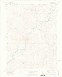
1972 Map of Radium
USGS Topo · Published 1976About this map
The Colorado River carves a winding path through this 1970s survey of Grand and Eagle Counties, defining the transportation and settlement patterns of the high country. The small community of Radium sits at a crucial bend in the river, serving as a focal point near the Red Gorge where several trails and jeep trails converge from the surrounding uplands. The Denver and Rio Grande Western Railroad tracks follow the river's northern bank, passing through a series of tunnels and the Azure station, illustrating the engineering required to navigate this corridor.
Find a feature on this map
30 named features on this map. Tap any name to fly to it.
Don’t see what you’re looking for? This feature index may not catch every label — zoom into the map to look around manually.
Map Details
Editions of this 1972 Radium Map
This is the sole edition of this map. No revisions or reprints were ever made.
Other maps of this area

1933 · Mt. Powell
USGS Topo · 1:48,000

1940 · Mount Powell
USGS Topo · 1:62,500

1954 · Craig
USGS Topo · 1:250,000

1956 · Kremmling
USGS Topo · 1:62,500

1956 · Gore Pass
USGS Topo · 1:62,500

1957 · Craig
USGS Topo · 1:250,000

1957 · Leadville
USGS Topo · 1:250,000

1958 · Craig
USGS Topo · 1:250,000

1959 · Leadville
USGS Topo · 1:250,000

1960 · Leadville
USGS Topo · 1:250,000