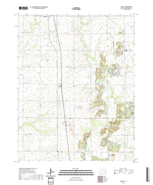
2022 Map of Radley
USGS Topo · Published 2022About this map
Girard occupies the northwest corner of this Crawford County landscape, where the flat agricultural plains are carved by several significant drainages. The area is characterized by a grid of rural roads and small settlements like Beulah and Radley, reflecting the long-established survey townships of the region. Waterways such as Second Cow Cr and Limestone Cr meander through the terrain, often flanked by the low-lying wetlands that define the local hydrology. Local heritage is preserved at sites like the Beulah Cem and West Union Cem, which serve as landmarks for the surrounding rural community. The presence of South Radley and the southern point of Filler further illustrates the dispersed nature of habitation across the Crawford County countryside in the early 21st century.
Find a feature on this map
48 named features on this map. Tap any name to fly to it.
Don’t see what you’re looking for? This feature index may not catch every label — zoom into the map to look around manually.
Map Details
Editions of this 2022 Radley Map
This is the sole edition of this map. No revisions or reprints were ever made.
Other maps of this area

1884 · Fort Scott
USGS Topo · 1:125,000

1886 · Joplin
USGS Topo · 1:125,000

1886 · Fort Scott
USGS Topo · 1:125,000

1893 · Fort Scott
USGS Topo · 1:125,000

1894 · Joplin
USGS Topo · 1:125,000

1943 · Cherokee
USGS Topo · 1:62,500

1945 · Pittsburg
USGS Topo · 1:62,500

1945 · Cherokee
USGS Topo · 1:62,500

1947 · Joplin
USGS Topo · 1:250,000

1947 · Pittsburg
USGS Topo · 1:62,500