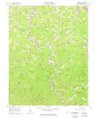
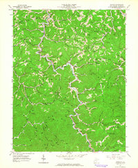
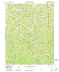
1962 Map of Radnor
USGS Topo · Published 1977About this map
The West Fork Twelvepole Creek carves a winding path through this corner of Wayne County, serving as the primary drainage for a landscape defined by sharp ridges and deep hollows. Small communities like Genoa, Radnor, and Dunlow are established along the narrow valley floors, connected by roads that hug the water's edge. Higher elevations are dominated by features such as Lycans Ridge and Stonewall, where local infrastructure including the Lycans Ridge Sch and several Gas Wells indicate the area's rural economy.
Find a feature on this map
100 named features on this map. Tap any name to fly to it.
Don’t see what you’re looking for? This feature index may not catch every label — zoom into the map to look around manually.
Map Details
Editions of this 1962 Radnor Map
3 editions found
Other maps of this area

1886 · Prestonsburg
USGS Topo · 1:125,000

1887 · Warfield
USGS Topo · 1:125,000

1891 · Warfield
USGS Topo · 1:125,000

1892 · Prestonsburg
USGS Topo · 1:125,000

1892 · Huntington
USGS Topo · 1:125,000

1898 · Huntington
USGS Topo · 1:125,000

1903 · Kenova
USGS Topo · 1:125,000

1904 · Kenova
USGS Topo · 1:125,000
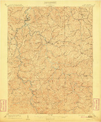
1909 · Wayne
USGS Topo · 1:62,500

1910 · Naugatuck
USGS Topo · 1:48,000