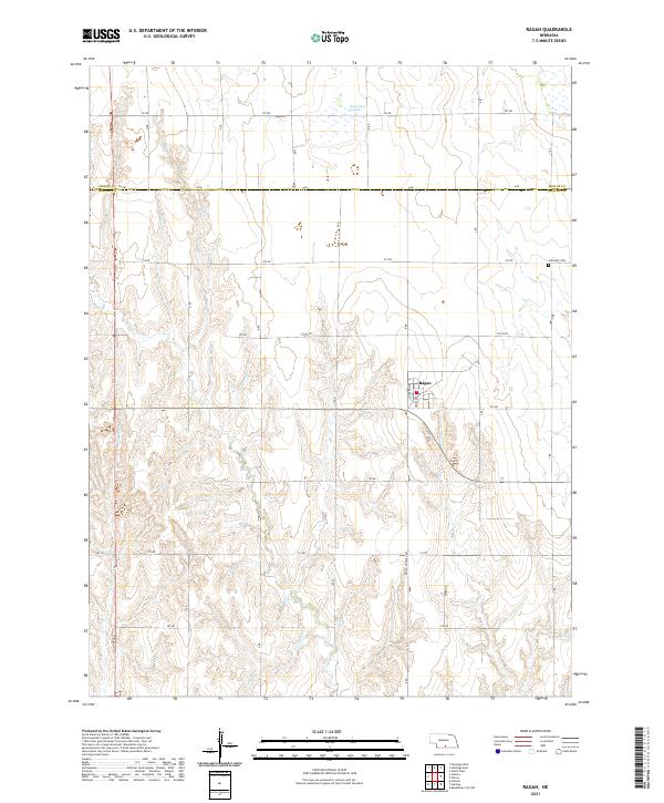
2021 Map of Ragan
USGS Topo · Published 2021About this map
Ragan sits at the intersection of local routes in the undulating plains of Harlan County, serving as a primary point of settlement in this rural landscape. The village layout is defined by Decker Ave and Cross Ave, providing a structured core amidst an expansive grid of section roads like the Ragan-Huntley Rd. The surrounding terrain is marked by ephemeral water features and drainages, most notably Richardson Lagoon to the north and the winding course of Rope Cr to the southwest.
Find a feature on this map
30 named features on this map. Tap any name to fly to it.
Don’t see what you’re looking for? This feature index may not catch every label — zoom into the map to look around manually.
Map Details
Editions of this 2021 Ragan Map
This is the sole edition of this map. No revisions or reprints were ever made.
Other maps of this area

1896 · Holdrege
USGS Topo · 1:125,000

1955 · Grand Island
USGS Topo · 1:250,000

1957 · Grand Island
USGS Topo · 1:250,000

1958 · Grand Island
USGS Topo · 1:250,000

1970 · Holdrege East
USGS Topo · 1:24,000

1970 · Axtell West
USGS Topo · 1:24,000

1970 · Wilcox
USGS Topo · 1:24,000

1970 · Ragan
USGS Topo · 1:24,000
1970 · Holdrege West
USGS Topo · 1:24,000
1970 · Atlanta
USGS Topo · 1:24,000