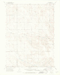
1973 Map of Rago
USGS Topo · Published 1976About this map
The High Plains landscape of eastern Colorado is defined by energy extraction and intermittent drainage patterns in this early 1970s survey. Industrial activity is centered on the Rago Oil Field and the North Rago Oil Field, where numerous sites are marked as Oil Well or Drill Hole. These operations follow the contours of the land above the Base Line, illustrating the intersection of natural topography and late-twentieth-century resource development.
Find a feature on this map
9 named features on this map. Tap any name to fly to it.
Don’t see what you’re looking for? This feature index may not catch every label — zoom into the map to look around manually.
Map Details
Editions of this 1973 Rago Map
3 editions found

Other maps of this area

1954 · Limon
USGS Topo · 1:250,000

1954 · Sterling
USGS Topo · 1:250,000

1957 · Limon
USGS Topo · 1:250,000

1958 · Limon
USGS Topo · 1:250,000

1958 · Sterling
USGS Topo · 1:250,000

1965 · Gary
USGS Topo · 1:24,000

1965 · Miller Ranch
USGS Topo · 1:24,000

1973 · Woodrow
USGS Topo · 1:24,000

1973 · Antelope Creek East
USGS Topo · 1:24,000

1973 · Antelope Creek West
USGS Topo · 1:24,000