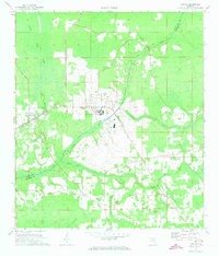
1970 Map of Raiford
USGS Topo · Published 1973About this map
Florida State Prison dominates the central landscape of this Union and Bradford County border region, featuring an extensive complex that includes a Water Tank, Sewage Disposal facilities, and its own Landing Strip. The town of Raiford sits to the west along the Seaboard Coast Line railroad, while the rural surroundings are defined by numerous community landmarks. Local family and congregational history is preserved in sites like New River Ch, Evergreen Cem, and Dyal Cem. The natural drainage of the area is governed by the meandering New River, which forms a significant portion of the county boundary, joined by tributaries such as Turkey Creek, Alligator Creek, and Water Oak Creek. To the southeast, the settlement of Heilbronn is situated near the notable Heilbronn Spring, illustrating the traditional importance of water sources in Florida's interior development during the mid-20th century.
Find a feature on this map
24 named features on this map. Tap any name to fly to it.
Don’t see what you’re looking for? This feature index may not catch every label — zoom into the map to look around manually.
Map Details
Editions of this 1970 Raiford Map
2 editions found
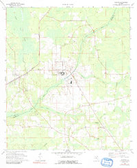
Other maps of this area

1918 · Lawtey
USGS Topo · 1:62,500

1941 · Starke
USGS Topo · 1:62,500

1948 · Starke
USGS Topo · 1:50,000

1949 · Sampson
USGS Topo · 1:24,000

1949 · Starke
USGS Topo · 1:24,000

1949 · Starke
USGS Topo · 1:62,500

1954 · Gainesville
USGS Topo · 1:250,000

1954 · Valdosta
USGS Topo · 1:250,000

1958 · Valdosta
USGS Topo · 1:250,000

1958 · Gainesville
USGS Topo · 1:250,000