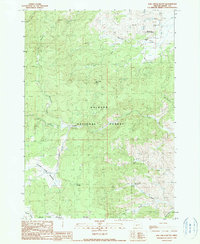
1990 Map of Rail Creek Butte
USGS Topo · Published 1990About this map
Rail Creek Butte stands as a prominent geographic center point within the heavily forested terrain of Grant County, Oregon. This 1990 provisional map documents a landscape defined by its intricate drainage systems and seasonal high-altitude meadows. To the north, Bear Valley opens up, hosting the Koehler Ranch near the banks of Shirttail Creek. The map provides a detailed view of the Malheur National Forest, where numerous water sources like Officer Springs and Flat Creek Spring emerge from the slopes. The southern portion is characterized by wide riparian zones including Myrtle Park Meadows and Crooked Creek Meadows, which suggest a history of grazing and water management in the region. Several family-named or descriptive features such as Jack Andy Creek and Burntcabin Creek offer clues to early homesteading and land use patterns in this part of the Blue Mountains.
Find a feature on this map
25 named features on this map. Tap any name to fly to it.
Don’t see what you’re looking for? This feature index may not catch every label — zoom into the map to look around manually.
Map Details
Editions of this 1990 Rail Creek Butte Map
This is the sole edition of this map. No revisions or reprints were ever made.
Other maps of this area

1955 · Burns
USGS Topo · 1:250,000

1955 · Canyon City
USGS Topo · 1:250,000

1958 · Burns
USGS Topo · 1:250,000

1959 · Burns
USGS Topo · 1:250,000

1959 · Canyon City
USGS Topo · 1:250,000

1959 · West Myrtle Butte
USGS Topo · 1:62,500

1961 · Calamity Butte
USGS Topo · 1:62,500

1961 · Logdell
USGS Topo · 1:62,500

1961 · Seneca
USGS Topo · 1:62,500

1978 · John Day
USGS Topo · 1:100,000