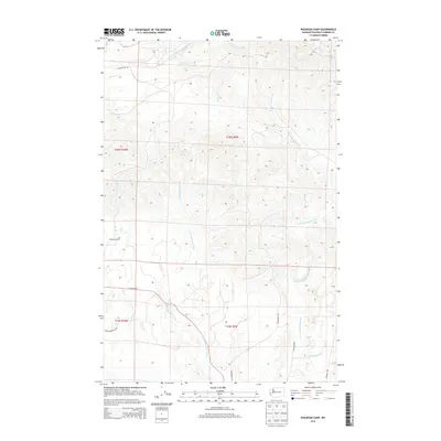
2014 Map of Railroad Camp
USGS Topo · Published 2014About this map
The Railroad Camp vicinity in Grays Harbor County serves as a significant drainage hub where several major river systems originate and diverge. The landscape is defined by the headwaters of the East Fork Humptulips River in the north and the multiple branches of the W Fork Wishkah River and E Fork Hoquiam River that cut through the terrain to the south. This network of waterways, including Brittain Cr and Big Cr, underscores the area's historical importance to the regional timber industry, providing the natural infrastructure necessary for moving logs from the interior forests toward the coastal mills.
Find a feature on this map
19 named features on this map. Tap any name to fly to it.
Don’t see what you’re looking for? This feature index may not catch every label — zoom into the map to look around manually.
Map Details
Editions of this 2014 Railroad Camp Map
This is the sole edition of this map. No revisions or reprints were ever made.
Other maps of this area

1921 · Quinault Lake
USGS Topo · 1:62,500

1921 · Satsop
USGS Topo · 1:62,500

1941 · Mobray
USGS Topo · 1:62,500

1943 · Humptulips
USGS Topo · 1:62,500

1943 · Mobray
USGS Topo · 1:62,500

1955 · Wynoochee Valley
USGS Topo · 1:62,500

1955 · Grisdale
USGS Topo · 1:62,500

1955 · Humptulips
USGS Topo · 1:62,500

1955 · Quinault Lake
USGS Topo · 1:62,500

1958 · Seattle
USGS Topo · 1:250,000