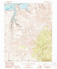
1987 Map of Rainbow Bridge
USGS Topo · Published 1987About this map
Navajo Indian Reservation lands dominate the southern portion of this region, meeting the high slopes of Navajo Mountain near the Arizona-Utah border. The landscape is defined by deep drainage systems like Aztec Creek and Forbidding Canyon, which feed northward into the inundated waters of Lake Powell and the Colorado River. This 1987 provisional mapping highlights the intricate labyrinth of the Glen Canyon National Recreation Area, where geological landmarks like the Rainbow Bridge National Monument and the secluded Owl Bridge stand amidst the erosion-carved terrain. Historic transit routes through the high country are evidenced by Redbud Pass and various named canyons such as Tsagieto Canyon and Dome Canyon, reflecting a landscape where movement is dictated by the steep vertical relief and the presence of the water table.
Find a feature on this map
32 named features on this map. Tap any name to fly to it.
Don’t see what you’re looking for? This feature index may not catch every label — zoom into the map to look around manually.
Map Details
Editions of this 1987 Rainbow Bridge Map
2 editions found
Other maps of this area

1883 · Marsh Pass
USGS Topo · 1:250,000

1886 · Escalante
USGS Topo · 1:250,000

1886 · Henry Mountains
USGS Topo · 1:250,000

1886 · Echo Cliffs
USGS Topo · 1:250,000

1891 · Echo Cliffs
USGS Topo · 1:250,000

1892 · Marsh Pass
USGS Topo · 1:250,000

1892 · Henry Mountains
USGS Topo · 1:250,000

1953 · Cummings Mesa
USGS Topo · 1:62,500

1953 · Navajo Mountain
USGS Topo · 1:62,500

1954 · Navajo Creek
USGS Topo · 1:62,500