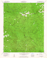
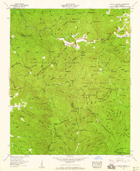
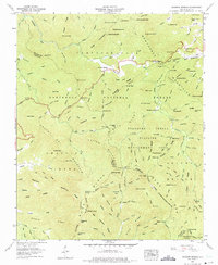
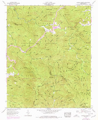
1957 Map of Rainbow Springs
USGS Topo · Published 1963About this map
The Nantahala River carves through this pocket of the Blue Ridge, anchored by the small settlement of Rainbow Springs. In the late 1950s, this landscape was defined by the intersection of the Appalachian Trail and the high ridges of Chunky Gal Mountain and the Nantahala Mountains. This area serves as a significant crossroads for topographical survey and wildlife conservation, containing the Standing Indian Wildlife Management Area and the Nantahala National Forest.
Find a feature on this map
130 named features on this map. Tap any name to fly to it.
Don’t see what you’re looking for? This feature index may not catch every label — zoom into the map to look around manually.
Map Details
Editions of this 1957 Rainbow Springs Map
4 editions found
Other maps of this area

1886 · Dahlonega
USGS Topo · 1:125,000

1886 · Walhalla
USGS Topo · 1:125,000

1891 · Cowee
USGS Topo · 1:125,000

1892 · Dahlonega
USGS Topo · 1:125,000

1892 · Walhalla
USGS Topo · 1:125,000

1896 · Walhalla
USGS Topo · 1:125,000

1896 · Dahlonega
USGS Topo · 1:125,000

1897 · Cowee
USGS Topo · 1:125,000

1903 · Dahlonega
USGS Topo · 1:125,000

1907 · Cowee
USGS Topo · 1:125,000