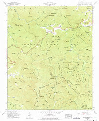
1957 Map of Rainbow Springs
USGS Topo · Published 1975About this map
Rainbow Springs sits at the heart of this mountain landscape, positioned along the winding Nantahala River within the vast Nantahala National Forest. The map documents a rugged interior geography where high peaks like Courthouse Bald and Kimsey Bald overlook a complex network of ridges and deep water gaps. Human presence is marked by high-altitude crossings and industrial remnants, such as a dismantled railroad tracing the river valley and a lookout tower on a prominent summit. Notable terrain features like Crawford Flats and Grassy Gap provide specific points of reference for those studying the early 20th-century topography of the Macon and Clay County border. The Appalachian Trail snakes through the high country, connecting remote gaps like Deep Gap and Sassafras Gap as it traverses the divide.
Find a feature on this map
145 named features on this map. Tap any name to fly to it.
Don’t see what you’re looking for? This feature index may not catch every label — zoom into the map to look around manually.
Map Details
Editions of this 1957 Rainbow Springs Map
4 editions found
Other maps of this area

1886 · Dahlonega
USGS Topo · 1:125,000

1886 · Walhalla
USGS Topo · 1:125,000

1891 · Cowee
USGS Topo · 1:125,000

1892 · Dahlonega
USGS Topo · 1:125,000

1892 · Walhalla
USGS Topo · 1:125,000

1896 · Walhalla
USGS Topo · 1:125,000

1896 · Dahlonega
USGS Topo · 1:125,000

1897 · Cowee
USGS Topo · 1:125,000

1903 · Dahlonega
USGS Topo · 1:125,000

1907 · Cowee
USGS Topo · 1:125,000