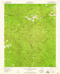
1957 Map of Rainbow Springs
USGS Topo · Published 1959About this map
Rainbow Springs serves as a small human footprint in this mid-century survey of the high mountain terrain where the Nantahala River begins its descent. The map is defined by the winding course of the Appalachian Trail as it traverses the Nantahala Mountains, crossing through several notable passes such as Winding Stair Gap, Wallace Gap, and Rock Gap. These gaps provided critical passage for travelers and early hunters through the dense Nantahala National Forest.
Find a feature on this map
139 named features on this map. Tap any name to fly to it.
Don’t see what you’re looking for? This feature index may not catch every label — zoom into the map to look around manually.
Map Details
Editions of this 1957 Rainbow Springs Map
4 editions found
Other maps of this area

1886 · Dahlonega
USGS Topo · 1:125,000

1886 · Walhalla
USGS Topo · 1:125,000

1891 · Cowee
USGS Topo · 1:125,000

1892 · Dahlonega
USGS Topo · 1:125,000

1892 · Walhalla
USGS Topo · 1:125,000

1896 · Walhalla
USGS Topo · 1:125,000

1896 · Dahlonega
USGS Topo · 1:125,000

1897 · Cowee
USGS Topo · 1:125,000

1903 · Dahlonega
USGS Topo · 1:125,000

1907 · Cowee
USGS Topo · 1:125,000