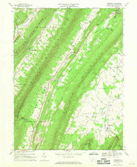
1967 Map of Rainsburg
USGS Topo · Published 1970About this map
Bedford Mountain and Wills Mountain dominate this landscape, creating a series of narrow, agriculturally focused valleys that defined the region's development into the late 1960s. The settlement at Rainsburg is a focal point of the eastern Colerain Cove, while Manns Choice sits to the northwest along the Penn Central rail line. Local springs, once the foundation of a famous mineral water and resort economy, are well-documented here, including Sulphur Springs, Magnesium Spring, and Crystal Spring.
Find a feature on this map
57 named features on this map. Tap any name to fly to it.
Don’t see what you’re looking for? This feature index may not catch every label — zoom into the map to look around manually.
Map Details
Editions of this 1967 Rainsburg Map
4 editions found
Other maps of this area

1900 · Everett
USGS Topo · 1:62,500

1902 · Everett
USGS Topo · 1:62,500

1908 · Bedford
USGS Topo · 1:62,500

1910 · Bedford
USGS Topo · 1:62,500

1927 · Clearville
USGS Topo · 1:48,000

1927 · Hyndman
USGS Topo · 1:62,500

1931 · Clearville
USGS Topo · 1:62,500

1931 · Hyndman
USGS Topo · 1:62,500

1944 · Hyndman
USGS Topo · 1:62,500

1944 · Clearville
USGS Topo · 1:62,500
Featured Places
- Rainsburg, PA
- Colerain Township, PA
- Bedford Township, PA
- Cumberland Valley Township, PA
- Harrison Township, PA