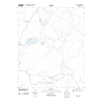
2010 Map of Rainsville
USGS Topo · Published 2010About this map
Coyote Creek and the Mora River converge in this high-altitude landscape of Mora County, where the historic communities of Rainsville and Golondrinas anchor a network of agricultural ditches and small-scale reservoirs. The area's settlement pattern is defined by traditional water management, featuring systems like the Buena Vista Ditch and North Golondrinas Ditch that feed the local ranching economy. For genealogists and local historians, the map preserves the locations of several burial grounds, including the Sacred Heart Church Cemetery and Jager Cemetery. Major landholdings such as Salman Ranch and Sixtynine Ranch sit alongside smaller named settlements like Webere and Marse. The presence of the Rainsville Post Office and the La Cueva Reservoir highlights the dual importance of community centers and water storage in this high plains environment.
Find a feature on this map
34 named features on this map. Tap any name to fly to it.
Don’t see what you’re looking for? This feature index may not catch every label — zoom into the map to look around manually.
Map Details
Editions of this 2010 Rainsville Map
This is the sole edition of this map. No revisions or reprints were ever made.
Other maps of this area

1889 · Las Vegas
USGS Topo · 1:125,000

1891 · Las Vegas
USGS Topo · 1:125,000

1893 · Las Vegas
USGS Topo · 1:125,000

1954 · Santa Fe
USGS Topo · 1:250,000

1954 · Raton
USGS Topo · 1:250,000

1958 · Raton
USGS Topo · 1:250,000

1958 · Santa Fe
USGS Topo · 1:250,000

1963 · Lake Isabel
USGS Topo · 1:24,000

1963 · Fort Union
USGS Topo · 1:24,000

1963 · Rainsville
USGS Topo · 1:24,000