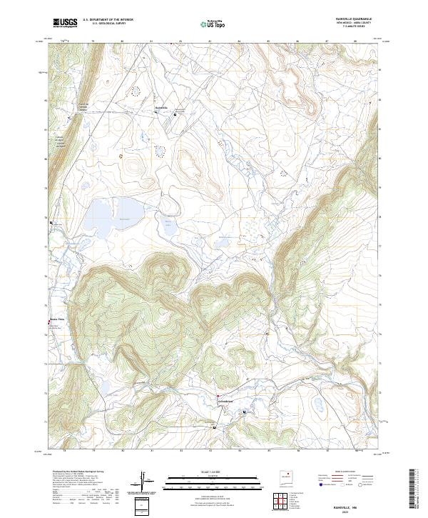
2023 Map of Rainsville
USGS Topo · Published 2023About this map
Mora River and Coyote Creek define the drainage of this high-elevation landscape in Mora County, where traditional northern New Mexico settlements are clustered along ancient watercourses. The village of Golondrinas sits at a strategic junction near the North Golondrinas Ditch, reflecting the enduring importance of acequia-style irrigation systems in the region. To the north, the community of Rainsville is anchored by the Sacred Heart Church Cem, while Buena Vista marks the western edge of the valley.
Find a feature on this map
30 named features on this map. Tap any name to fly to it.
Don’t see what you’re looking for? This feature index may not catch every label — zoom into the map to look around manually.
Map Details
Editions of this 2023 Rainsville Map
This is the sole edition of this map. No revisions or reprints were ever made.
Other maps of this area

1889 · Las Vegas
USGS Topo · 1:125,000

1891 · Las Vegas
USGS Topo · 1:125,000

1893 · Las Vegas
USGS Topo · 1:125,000

1954 · Santa Fe
USGS Topo · 1:250,000

1954 · Raton
USGS Topo · 1:250,000

1958 · Raton
USGS Topo · 1:250,000

1958 · Santa Fe
USGS Topo · 1:250,000

1963 · Lake Isabel
USGS Topo · 1:24,000

1963 · Fort Union
USGS Topo · 1:24,000

1963 · Rainsville
USGS Topo · 1:24,000