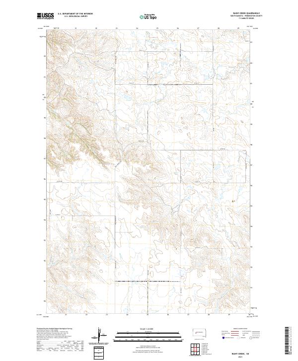
2021 Map of Rainy Creek
USGS Topo · Published 2021About this map
Rainy Cr and its tributaries define the drainage patterns of this Pennington County landscape as it appeared in the early 21st century. The map shows a highly structured section-line road network, where routes like 190th Ave and 219th St navigate the dissected uplands. This area is characterized by the convergence of several significant local drainages, including the N Fork Rainy Cr and S Fork Rainy Cr, which weave through the terrain before joining the main stem.
Find a feature on this map
23 named features on this map. Tap any name to fly to it.
Don’t see what you’re looking for? This feature index may not catch every label — zoom into the map to look around manually.
Map Details
Editions of this 2021 Rainy Creek Map
This is the sole edition of this map. No revisions or reprints were ever made.
Other maps of this area

1953 · Rapid City
USGS Topo · 1:250,000

1954 · Dalzell SE
USGS Topo · 1:24,000

1954 · Wasta NE
USGS Topo · 1:24,000

1954 · Wasta SE
USGS Topo · 1:24,000

1955 · Creighton
USGS Topo · 1:24,000

1955 · Pedro SE
USGS Topo · 1:24,000

1957 · Rapid City
USGS Topo · 1:250,000
1983 · Horse Tooth
USGS Topo · 1:24,000
1983 · Elm Creek Ranch
USGS Topo · 1:24,000
1983 · Lake Hill
USGS Topo · 1:24,000