
1953 Map of Raleigh
USGS Topo · Published 1965About this map
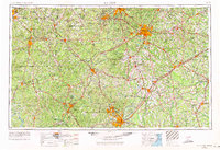
Raleigh serves as the focal point for this mid-century portrait of Central North Carolina, a landscape defined by its emerging highway system and established rail corridors. The regional economy is anchored by the Fort Bragg Military Reservation to the south and the massive expanse of the Uwharrie National Forest in the west. A complex web of transportation networks, including the Seaboard Air Line RR and Norfolk Southern RR, connects growing towns like Cary, Apex, and Zebulon. This era captures the transition between the old agricultural heartland and the modernizing Research Triangle region, visible in the proximity of Durham and Chapel Hill. Water resources are a dominant feature, with the Neuse River and Cape Fear River winding through several counties, alongside the significant waters of Lake Tillery and the Haw River.
Find a feature on this map
112 named features on this map. Tap any name to fly to it.
Don’t see what you’re looking for? This feature index may not catch every label — zoom into the map to look around manually.
Map Details
Editions of this 1953 Raleigh Map
4 editions found
Other maps of this area

1902 · Kenly
USGS Topo · 1:62,500

1902 · Rocky Mount
USGS Topo · 1:62,500

1902 · Spring Hope
USGS Topo · 1:62,500

1903 · Kenly
USGS Topo · 1:62,500

1904 · Rocky Mount
USGS Topo · 1:62,500

1904 · Springhope
USGS Topo · 1:62,500

1904 · Wilson
USGS Topo · 1:62,500

1906 · Four Oaks
USGS Topo · 1:48,000

1908 · Four Oaks
USGS Topo · 1:62,500

1909 · Coharie
USGS Topo · 1:62,500