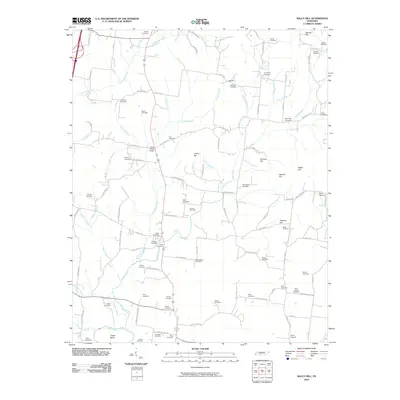
2010 Map of Rally Hill
USGS Topo · Published 2010About this map
Hurts Cross Roads serves as a central landmark in this rural Tennessee landscape, where the headwaters of Rutherford Creek and Flat Creek carve through a terrain defined by numerous family-named heights like Skinner Hill and Orchard Hill. The southern edge of the sheet is bounded by the winding Duck River, featuring the prominent Tugas Bend. This 2010 survey is an exceptional resource for genealogists, as it meticulously documents dozens of small burial grounds, including the Riley-Harper Cemetery, Shires Cemetery, and Macedonia Cemetery. The dense concentration of these sites, alongside names like Williams Cemetery and Boyd Cemetery, reflects a long-established pattern of family landholdings and small-scale settlements. The map also reveals the rural road network, with routes like Rally Hill Rd and Hardison Mill Rd connecting the scattered homesteads and hilltop pastures that characterize this portion of Middle Tennessee.
Find a feature on this map
114 named features on this map. Tap any name to fly to it.
Don’t see what you’re looking for? This feature index may not catch every label — zoom into the map to look around manually.
Map Details
Editions of this 2010 Rally Hill Map
This is the sole edition of this map. No revisions or reprints were ever made.
Other maps of this area

1909 · Franklin
USGS Topo · 1:62,500

1936 · Chapel Hill
USGS Topo · 1:24,000

1936 · Farmington
USGS Topo · 1:24,000

1936 · Verona
USGS Topo · 1:24,000

1936 · Rally Hill
USGS Topo · 1:24,000

1936 · Spring Hill
USGS Topo · 1:24,000

1936 · Carters Creek
USGS Topo · 1:24,000

1936 · Glendale
USGS Topo · 1:24,000

1936 · Bethesda
USGS Topo · 1:24,000

1941 · Carters Creek
USGS Topo · 1:24,000