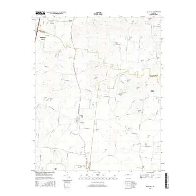
2016 Map of Rally Hill
USGS Topo · Published 2016About this map
The Duck River winds through the southern edge of this landscape, marking a topographically varied region where Maury, Williamson, and Marshall counties converge. The area is defined by a dense network of family cemeteries and small rural centers, including Rally Hill, Duplex, and Pottsville. These settlements are linked by historic thoroughfares like the Lewisburg and Franklin Pike, which runs north-south through the heart of the territory.
Find a feature on this map
133 named features on this map. Tap any name to fly to it.
Don’t see what you’re looking for? This feature index may not catch every label — zoom into the map to look around manually.
Map Details
Editions of this 2016 Rally Hill Map
This is the sole edition of this map. No revisions or reprints were ever made.
Other maps of this area

1909 · Franklin
USGS Topo · 1:62,500

1936 · Chapel Hill
USGS Topo · 1:24,000

1936 · Farmington
USGS Topo · 1:24,000

1936 · Verona
USGS Topo · 1:24,000

1936 · Rally Hill
USGS Topo · 1:24,000

1936 · Spring Hill
USGS Topo · 1:24,000

1936 · Carters Creek
USGS Topo · 1:24,000

1936 · Glendale
USGS Topo · 1:24,000

1936 · Bethesda
USGS Topo · 1:24,000

1941 · Carters Creek
USGS Topo · 1:24,000