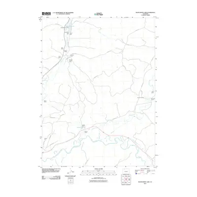
2010 Map of Ralph White Lake
USGS Topo · Published 2010About this map
The Yampa River winds through the southern portion of this landscape, supported by an intricate network of irrigation systems including the Norvell Ditch, Smith Ditch, and Brock Adair Ditch. This 2010 survey illustrates the managed water resources of the region, anchored by Ralph White Lake and the Leftwich Reservoir. The map reveals a history of extraction and engineering, from the Hindman Mine in the southwest to several containment structures such as Fortification Creek Dam and Liftwich Dam. Numerous named terrain features like Agee Gulch and Hayden Cutoff Draw partition the upland areas, while the Wisconsin Ditch and Deep Cut Ditch trace the efforts to redirect water across this high-altitude terrain. The presence of Dowden Bridge over Fortification Creek marks a critical crossing point in a region defined by its rugged drainages and carefully channeled water ways.
Find a feature on this map
38 named features on this map. Tap any name to fly to it.
Don’t see what you’re looking for? This feature index may not catch every label — zoom into the map to look around manually.
Map Details
Editions of this 2010 Ralph White Lake Map
This is the sole edition of this map. No revisions or reprints were ever made.
Other maps of this area

1910 · Danforth Hills
USGS Topo · 1:125,000

1915 · Monument Butte
USGS Topo · 1:62,500

1916 · Craig
USGS Topo · 1:125,000

1916 · Daton Peak
USGS Topo · 1:62,500

1920 · Daton Peak
USGS Topo · 1:62,500

1923 · Elkhead Creek
USGS Topo · 1:62,500

1924 · Elkhead Creek
USGS Topo · 1:62,500

1954 · Craig
USGS Topo · 1:250,000

1957 · Craig
USGS Topo · 1:250,000

1958 · Craig
USGS Topo · 1:250,000