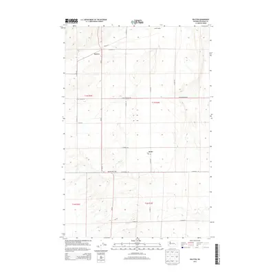
2013 Map of Ralston
USGS Topo · Published 2013About this map
Ralston serves as a central hub in this portion of Adams County, where the intersection of Wa-261 and local thoroughfares like Bierman Rd define the local transit pattern. This eastern Washington landscape is characterized by the broad expanse of Rattlesnake Flat to the south and the winding path of Lind Coulee in the north. The map reveals a highly structured agricultural grid, with section lines and gravel roads such as E Providence Rd and E Ralston Benge Rd organizing the dryland farming country. Further south, the small settlement of Bemis is marked primarily by the Bemis Cem, providing a specific point of interest for genealogists and local historians tracing family lineages in this rural wheat-growing region.
Find a feature on this map
23 named features on this map. Tap any name to fly to it.
Don’t see what you’re looking for? This feature index may not catch every label — zoom into the map to look around manually.
Map Details
Editions of this 2013 Ralston Map
This is the sole edition of this map. No revisions or reprints were ever made.
Other maps of this area

1923 · Washtucna
USGS Topo · 1:62,500

1925 · Washtucna
USGS Topo · 1:62,500

1950 · Benge
USGS Topo · 1:62,500

1952 · Benge
USGS Topo · 1:62,500

1953 · Walla Walla
USGS Topo · 1:250,000

1953 · Ritzville
USGS Topo · 1:250,000

1958 · Walla Walla
USGS Topo · 1:250,000

1959 · Ritzville
USGS Topo · 1:250,000

1964 · Marengo
USGS Topo · 1:24,000

1965 · Ritzville
USGS Topo · 1:250,000